読み込み中...

dangerous Yusra
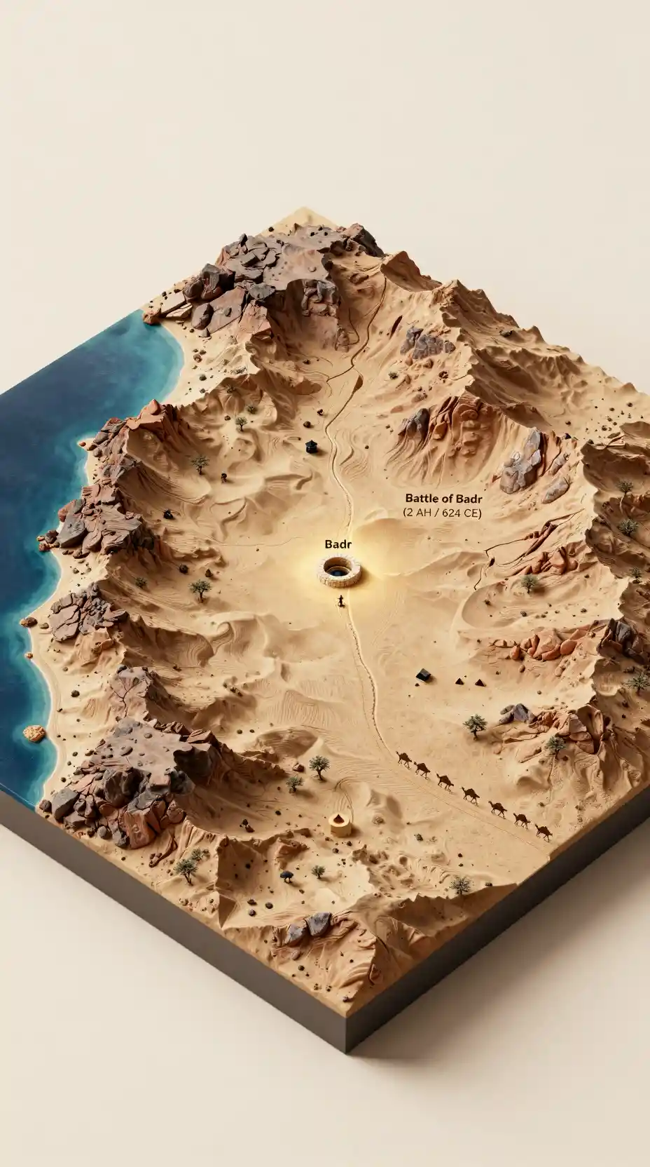
バドル地方の等角砂漠渓谷ジオラマ
プロンプト
Transform this satellite geography of the Badr area into a highly detailed 3D isometric physical terrain diorama in the style of a studio photograph of a miniature topographic model, depicting the Hijaz region in 624 CE (2 AH). The terrain floats as a sculpted landmass against a clean, off-white studio background with soft, even lighting from the upper left casting subtle shadows beneath the model.
Terrain transformation: Convert the satellite view into a photorealistic miniature physical model in warm desert earth tones — sandy beige, light ochre, terracotta, and dark volcanic brown. The western edge shows the coastal plain (Tihamah) sloping gently toward the Red Sea rendered as a smooth, translucent deep-blue resin surface. The terrain rises eastward into rugged basalt and granite hills with realistic rocky textures. The central area shows a broad, flat sandy valley floor with subtle undulations — this is the Plain of Badr. Sinous dry wadis carve through the landscape. Sparse acacia and thorn scrub dot the wadi beds. No modern roads, buildings, or infrastructure remain.
The Battle of Badr (highlighted): In the center of the valley, mark the approximate location of the Battle of Badr with a subtle, elegant visual accent — a slightly raised or differently textured area on the sandy plain, or a faint warm glow. Near this spot, show a cluster of stone-lined wells (the Wells of Badr) with tiny figures drawing water. The battlefield area is a flat, open sandy plain flanked by low rocky hills to the east and the coastal escarpment to the west. Show the terrain features that shaped the battle: the sandy ground where the two armies met, the slightly elevated ground to the southeast, and the natural choke points between the hills.
6th/7th century details: Add tiny Bedouin-style black goat-hair tents and small camel corrals near the wells, representing the pre-battle encampments. Show a thin, winding caravan trail passing through the valley — the historic Mecca-Medina trade route that made this location strategically vital. A tiny string of loaded camels can be seen on the trail to the south. The landscape should feel arid, harsh, and sparsely inhabited.
Labels: Clean, modern sans-serif white text with subtle dark outlines. Primary label: "Badr" placed near the wells. "Battle of Badr (2 AH / 624 CE)" elegantly positioned near the highlighted battlefield area. Sec
Model
Z Image Turbo
Date created
08/10/26 at 2:19 PM
Seed
266325027
Guidance Scale
1
Resolution
928 x 1664 (9:16)
Related images