
Madhya Pradesh Plateau Regions Infographic
About This Madhya Pradesh Plateau Infographic
A closer look at the subject, style and details in this image.
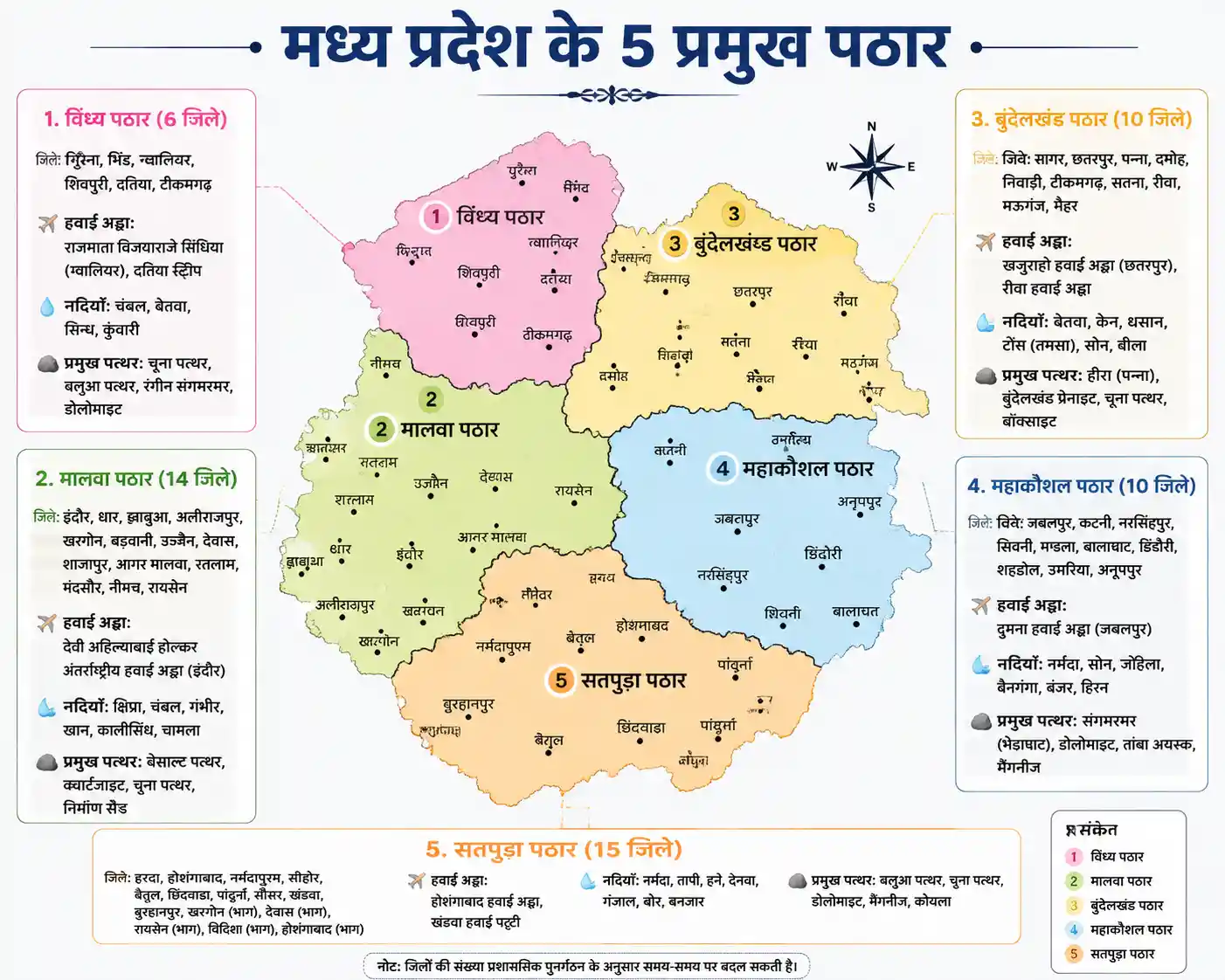
The artwork presents five plateau regions of Madhya Pradesh in a geography-focused infographic. It pairs each region with district information and details about rivers, airports, and notable stones or minerals, including Panna diamonds and marble from Bhedaghat.
A structured data visualization approach makes the regional information easy to scan, with distinct colors separating the areas. This concept suits an educational poster or a classroom geography reference about Madhya Pradesh.
Creative Style & Details
The details that give this artwork its look.
Subject
The infographic focuses on five plateau regions of Madhya Pradesh: Vindhya, Malwa, Bundelkhand, Mahakoshal, and Satpura.
Visual Style
A data visualization presents geographic and regional information in a structured graphic, rather than as a landscape scene.
Typography & Text
Regional headings organize details such as district names, airports, rivers, and major stones or minerals.
Color Palette
The regions are assigned distinct pastel colors, including pink, green, yellow, light blue, and orange.
Create Your Own Madhya Pradesh Plateau Infographic
Use this artwork's visual ideas as a starting point and give the scene your own direction.
AI suggestion based on this artwork.
Related images